
Wayfinding Update!
The guide is complete! You can find the guide on our resources tab (https://www.wmtrails.org/wayfinding-signage-guide).
Please let us know if we can be of any assistance.
Background: Over the past few decades, West Michigan has experienced significant growth in non-motorized trails and bikeways, including hundreds of miles of new regional facilities.
Work continues to complete connections between major urban centers and/or destination areas, particularly between the city of Grand Rapids and the lakeshore communities of Grand Haven, Holland, and Muskegon. As the demand for and usage of these pathways increases, including more recently significant use increases related to the Covid-19 pandemic, there has been a concurrent recognition by regional planners and stakeholders that there is inadequate wayfinding to comfortably guide users through the regional pathway system.

Photo credit: Toole Design Group, Location: Oak Leaf Trail in Milwaukee, Wisconsin
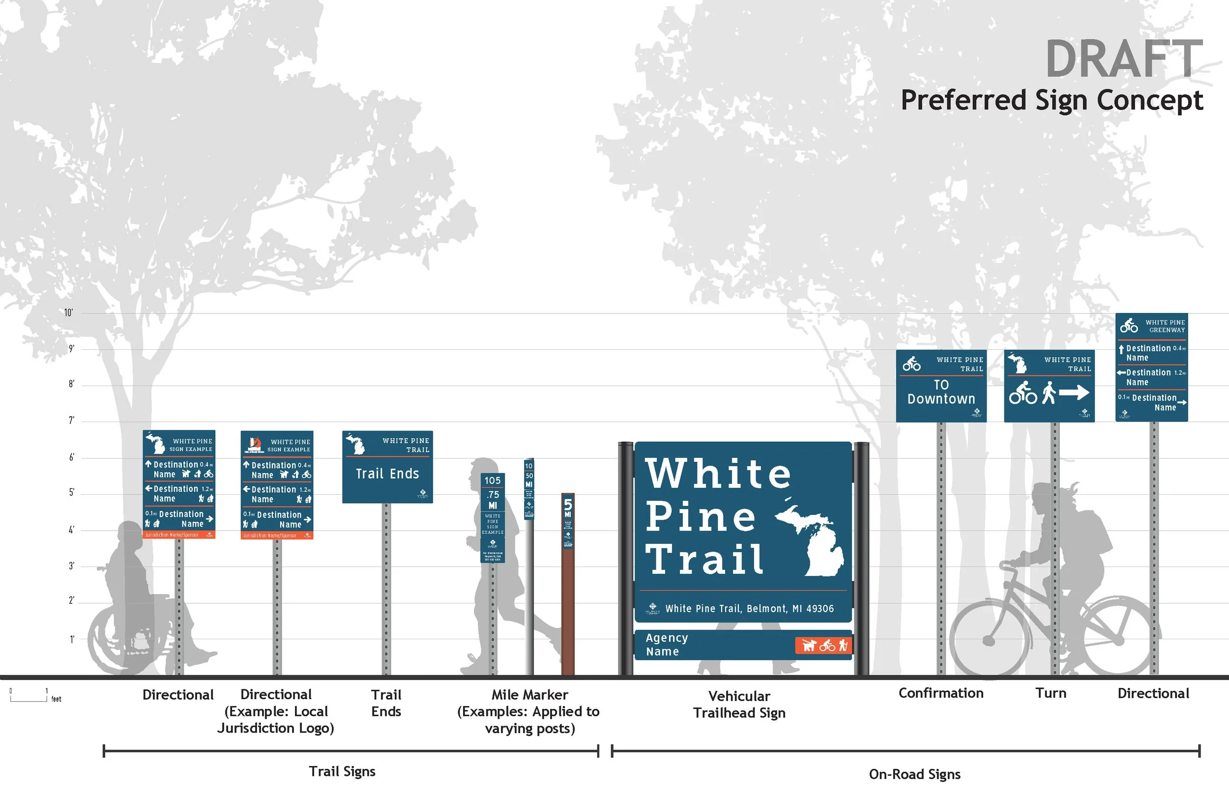
Recognizing the need for consistent wayfinding for West Michigan’s regional trail and bikeway network, West Michigan Trails has brought together stakeholders to develop a recommended framework for regulatory/safety and wayfinding signage on our regional trail network. The desired signage needs to work on shared-use trails and on-street bicycle systems, functioning as a cohesive network.
Toole Design Group from Columbus, Ohio is the consultant for this project.